Showing posts with label Coast to Coast. Show all posts

Sunday, 23 September 2012

Smardale Gill Circular

Smardalegill Circular 

12 miles

A relatively low level ramble; we walked this circular at the end of July. 

We started from the market place in Kirkby Stephen and headed north before turning into Silver Street and Christian Head. Just past the entrance to Kirkby Stephen Grammar School, we turned left into Bloody Bones Lane, leaving the tarmac behind. Our gently climbing route followed a field boundary in an westerly direction. We had a choice of paths at a field gate. Seeing cows and their young, we avoided them by taking a footpath along a farm track and through the farmyard at Sandwath. Our presence prompted a chorus of barking from the residents of kennels there. We were pleased to reach the quiet of a minor road and set off down it for some 500 metres or so until we reached the second of two bridges over railway cuttings.
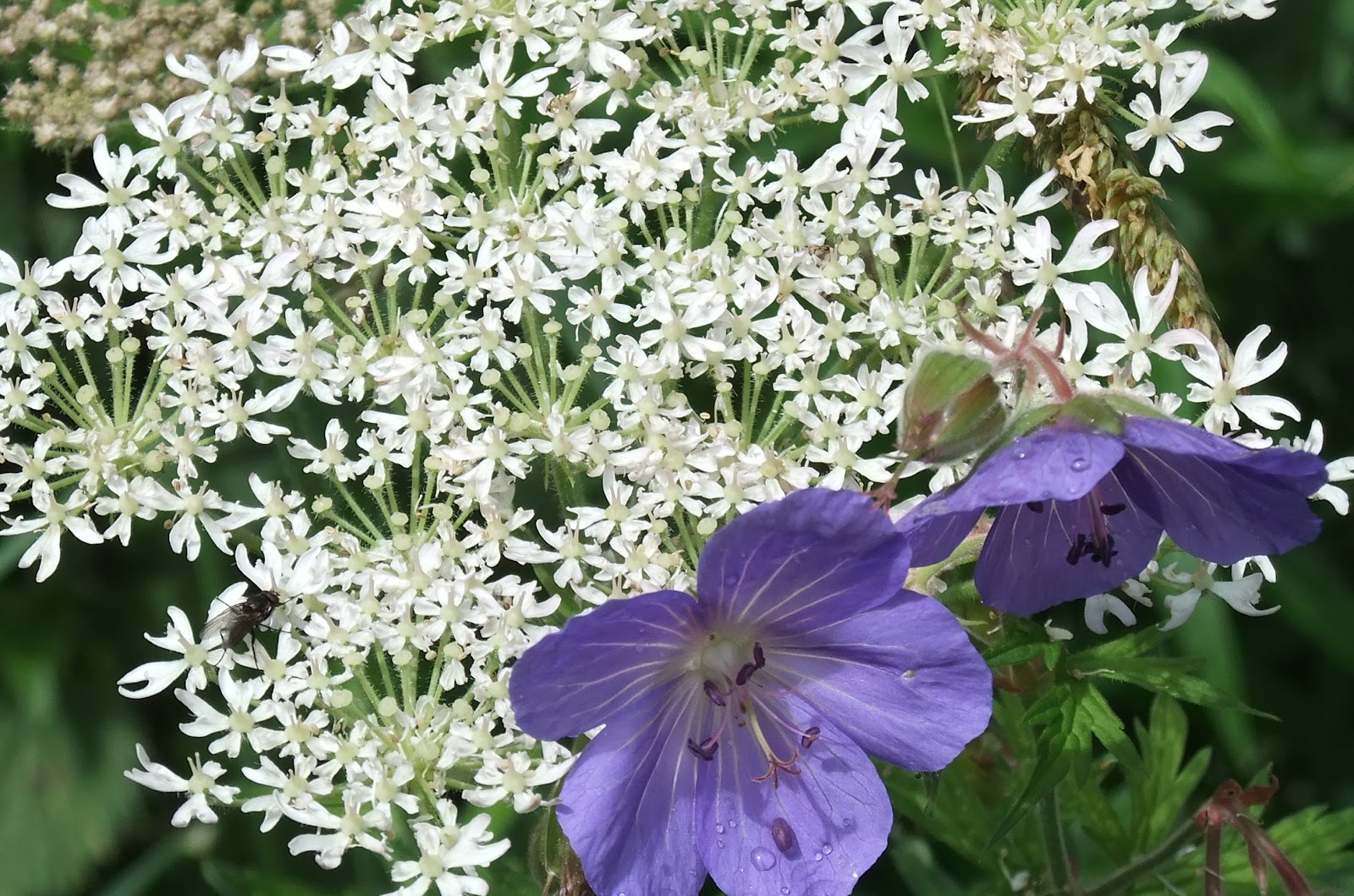
Waitby Nature Reserve

Steps down gave access to Waitby nature reserve (a dismantled railway). Walking west, we followed the curve of the former line. It was a peaceful walk along a permissive path, brightened by all manner of wild flowers just reaching perfection.


The nature reserve path came out at Smardale Hall. We followed Beck Lane for 100 metres before turning south into a car park which served the start of the Smardale Gill National Nature Reserve. 
Signage in the car park


Car parks often signal popularity. Along this stretch of our walk we met several people out for a stroll through the wooded Demesne Wood.  Before long, we were heading south and enjoying a light shower. Eventually, the rain ceased and we came to the impressive curve of Smardalegill Viaduct. We could have continued over the viaduct, but we wanted to be able to see the product of Victorian engineering and toil.

We left broad way, taking a small footpath which contoured the hillside. We left the strollers, who preferred to cross the viaduct. Our picnic spot had an unrivalled view of the viaduct and Scandal Beck far below. As we munched, thoughts inevitably turned to the hundreds and maybe thousands who must have laboured in difficult conditions, without the benefit of 'health and safety', to make the transport of raw materials and eventually passengers possible in the nineteenth century. The beauty of the structure was not in question. It was only spoilt by the late twentieth century addition of railing to protect foot traffic.
Smardalegill Viaduct


Onwards and upwards. Our footpath took us to a stile, which we crossed, before heading down a little until we joined up with the bridleway that forms part of Wainwright's Coast to Coast route. Down to the right was the old Smardale Bridge. Our route, however, turned east up over the access land on Smardale Fell. It was a steady up as we followed a wall boundary. Here, once again, we noticed that the drystone walls were a mixture of grey and the red of sandstone. We had noticed the change in land colour some two years previously when we walked the Coast to Coast route. We had been amazed at the vibrant earth that had characterised the west coast of England near to St. Bees. From now on we would be following the route taken by 'coasters' on their approach to Kirkby Stephen.

Looking back to Smardalegill Viaduct from near Smardale Bridge
The bridleway ran alongside two closely parallel walls which reminded me of a gallops. Behind us, the Howgills were being threatened by ominous looking clouds which were following us. Would we be pulling our wet weather clothes from our rucksacks? Ahead, high on the skyline, were the tiny cairns guarding Nine Standards Rigg. We headed downhill to a minor road. We turned south west along it for 150 metres and took another small road off to the left. After another 150 metres, we were heading off across the fields along a clearly visible footpath. We passed underneath the Settle-Carlisle railway line and continued through fields of photogenic sheep to Greenriggs Farm. Skirting the farm buildings, we joined up with Croglam Lane which eventually runs parallel with the main road through Kirkby Stephen.

Croglam Lane
We continued along the lane until we came to a small children's playground. Turning right onto a narrow tarmac road, we joined Kirkby Stephen High Street. A left turn took us back in the direction of the market place.

It had been a lovely walk of varied terrain. As we had walked over Smardale Fell we were treated to wonderful views of the Pennines. Until the last, Kirkby Stephen had stubbornly refused to reveal itself as we approached. 

Oh... and we managed to stay dry!

Sunday, 12 August 2012

Nine Standards Rigg & Tailbridge Hill

Nine Standards Rigg & Tailbridge Hill

Circular from Kirkby Stephen - 10 miles

Waking to a beautiful blue sky punctuated by white fluffy clouds, today was an opportunity to visit an old friend and make acquaintance with a new one.
Hedgerow - viaduct walk

Coast to Coasters tend to leave Kirkby Stephen by way of the pretty market place and Frank's Bridge as they start walking to Nine Standards Rigg and the watershed. Our route followed a fingerpost in South Road across a couple of fields before entering Stenkrith park to join the Merrygill and Podgill viaduct walk. After crossing the second of viaducts, we came out onto the road that skirts Hartley quarry. 
Tarmac becomes track

As the road climbed, the views became more breathtaking. The Eden Valley, the Howgills, Mallerstang and the Northern Pennines. The metalled road became cobbled track up the bridleway on Hartley Fell. A beautiful, high-backed, wooden seat provided in memory of a man who clearly loved the spot, gave us the excuse to stop, take in the view and rehydrate. It was a warm day and we were going to need to drink plenty of water. We followed a wall until a fingerpost signalled a permissive path, which for a while followed the course of Faraday Gill. A runner, back pack swinging from side to side, passed us. It looked like hard work. 
Tailbridge Hill from our route up Nine Standards Rigg

The summit cairns came into view, disappeared and reappeared as we walked further up. A wooden bridge and some judiciously placed pieces of stone enabled passage over a boggy bit of the pathway. Some wooden steps had long since become redundant as the top soil had eroded from the many footsteps made by the unknown numbers who journey this way each year. Today was a dry day and the path up was relatively easy, but we were still very surprised to see a pink sparkly pair of flip flop sandals start their descent of the hill. The stuff of nightmares - the stubbed toes - the potential broken ankle - the broken leg - the callout to mountain rescue. You do wonder!
High Dukerdale from Hartley Fell

From the cairns, we made our way to the hillfinder before taking a bearing to a bridleway at Rollinson Haggs. As the name suggests, it was squelchy underfoot and there was some careful negotiation across vegetation that we knew to be bog lovers. A fairly quick descent took us across Rollinson Gill and down to a stone wall. From here we discovered the little gem of Dukerdale lit by the afternoon sunshine. We sat just a short while before taking a bearing to the summit cairn of Tailbridge Hill, our second objective. Although a path could be seen in the grass from our starting point, it may have petered out. It was a gentle up, and before very long we were standing next to quite a substantial cairn. 
Tailbridge Hill cairn

What we had not forseen was the view here on Nateby Common. It was wonderful. The village of Nateby, its neighbour, Kirkby Stephen and the hills that surround the Upper Eden Valley. A good place to finish the last of the coffee and drink in the surroundings.
Taking in the view from Tailbridge Hill

Carefully, we dropped down quite quickly to a stone wall. We followed it until we joined the minor Nateby road, coming full circle at Stenkrith Bridge. Looking down we saw where we had joined the viaduct walk earlier in the day.

Looking back towards Tailbridge Hill

From the familiar to the new - Tailbridge Hill had been a revelation. Earlier in the day we had shared our walking plans with a passing dog walker. 

'That will be a nice walk.'

Rather an understatement.


Friday, 10 August 2012

Nine Standards Rigg

Nine Standards Rigg


662m

Nine Standards Rigg - a name engraved in the memories of 'Coast to Coasters'. It's situated some 4.5 miles from the small market town of Kirkby Stephen, and on a good day the cairns that give it it's name can be clearly seen from the town.

Its summit marks the Pennine watershed. On the Kirkby Stephen side, all watercourses flow to the west. As the summit is crossed, the walker soon finds themselves in Yorkshire, the watercourses flowing east to the North Sea.

Nine Standards is often the subject of conversation on walking forums as it has the reputation of being boggy. AW (Wainwright), in his Pictorial Guide, details three potential routes for the walker heading to Keld from Kirkby Stephen, according to the time of year. In 2010 we took the 'blue August to November' route which heads east before dropping down into Whitsundale. It was indeed boggy as we traversed peat hags. Before our 'crossing' in 2010, the subject of which route to take was very much to the fore amongst fellow walkers, as the weather was not promising.
Cloud finally revealing the Nine Standards - August 2010

That first climb of Nine Standards was shrouded in mystery. It rained. Clouds hung low. Our objective was elusive as mist swirled around and the 'up' seemed interminable. We weren't alone, as it seemed many were making the journey that day. It wasn't until we were within the last 100m or so that we finally saw them - the stone cairns - as the mist lifted and the rain ceased. We'd seen pictures of the standards, but nothing had quite prepared us for the sheer size of them. Many theories abound about why they're there. But if they were to feign  an army encampment, a better situation they could not command.

What we had not appreciated, on that first climb of Nine Standards Rigg, was the view from the top. There had been none. Fast forward to April 2012. A beautiful, clear day with blue sky and sunshine. As we climbed higher the views grew more expansive. The path took us through pure white snow, which looked stunning against the unsullied sky. We had sat on a ledge on one of the cairns to drink coffee and eat our lunch. We were in no rush - we weren't heading to Keld on this occasion. The objective was to enjoy the view that had elluded us nearly two years previously.
Nine Standards Rigg - April 2012

Today our climb of Nine Standards Rigg was but a part of a circular route. A blue sky and broken white cloud cheered us as we made our way up. The path was dry in all but a few places and visibility was good. The legs didn't seem to ache as much this time. Coffee and our packed lunch were eagerly awaited. Others were at the top today, but we still managed to find a 'perch' on one of the cairns. 
Wild Boar Fell from Nine Standards Rigg

Below us, the Upper Eden Valley, spotted with trees, lay before us like a blanket. To the north, the Northern Pennines stretched out into the distance and 'toy' lorries made their way along the A66. To the south, stood the Mallerstang Ridge and Wild Boar Fell. To the south-west, the Howgills. We picked out the fell that we had climbed earlier in the week. In front of us, the Lake District fells provided the backdrop. Little had we realised, on that rainy August day two years ago, what we had missed. We could return to this spot again and again and it would always refresh the soul. Facing east lay miles and miles of empty moorland - not our objective today.
High Seat from Nine Standards Rigg

'It was a fairly gentle climb up', said one walker at the summit into his mobile phone. 
'We've got the boggy bit now.'
He was walking east.

Approach to the summit of Nine Standards Rigg - 10th August 2012