Sunday 23 September 2012

Haystacks & Fleetwith Pike

Haystacks & Fleetwith Pike

It was a grey, damp and misty day as we headed off to the meeting point - a 'pay' car park behind Honister Youth Hostel. It always seems to take longer than you think for, travelling along lakeside roads, especially if following a bus or a car whose occupants are admiring the scenery. So, as we arrived (just in time), a good crowd had already assembled for the walk up Haystacks which was to be led by Lake District National Park volunteer rangers. We'd looked at the forecast on the MWIS website earlier in the morning and it was indicating that the weather was going to improve with good visibility later. 

We walked through the Honister slate mine car park and took the bridleway and then the path which followed the line of the long since dismantled tramway. It was a steady climb up, with rough cobbles and stone underfoot. I was pleasantly surprised to find that I was not finding it as difficult as I thought I might - hurrah! (We had walked down the tramway two years previously and I had thought then that coming up it would be tiring.) We paused at Drum House - we had to use our imagination - where the winding gear for getting slate trucks up and down the tramway had once been housed. Off to the left a distinct, soggy path snaked its way up and into the mist over Fleetwith. Our route continued along the tramway path before dropping down through the disused Dubs Quarry.  

Buttermere, Buttermere Dubs and Crummock Water

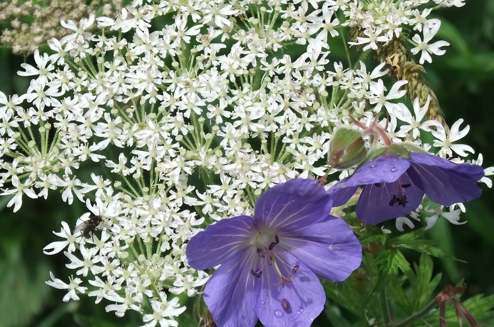
We had to carefully negotiate a stream which had become swollen from recent rainfall. Safely across, the footpath undulated generally upwards in a south westerly direction. Above Little Round How, we stopped for a quick coffee and a snack. It had a good view of Buttermere, Buttermere Dubs and, in the far distance, Crummock Water. There were signs of the weather improving and the mist starting to clear - even a glimpse of sunshine on a far fellside! On we went, with Blackbeck Tarn appearing to our left. A little further on, a balanced boulder caught our attention. 

Balanced on Haystacks

The landscape was not as I had imagined it - I don't know why. This route up Haystacks displayed a broad mass of rocky landscape. Now, looking at the OS map it's quite obvious. 

Inominate Tarn

Before long, we reached Inominate Tarn. A beautiful place - a rocky bowl filled with still water with Pillar appearing behind. From another viewpoint, Great Gable and Windy Gap could be seen clearly. There were plenty of people here. Even so, our group must have come as a bit of a shock to those who were already there. As we made our way to the summit cairn, we got a view of Ennerdale Water over to the west. At the summit there were 360 degrees of Lakeland felltops. No wonder AW. Wainwright favoured Haystacks so much. We retraced our steps to Inominate Tarn to eat our lunch. Many were up there to make the pilgrimmage. A D.of E. group, laden with large rucksacks, stopped for photos, closely followed by their supervisor. All too soon we were heading back along the way we had come. The stream that we had so carefully negotiated earlier in the day now had less water flowing down it. By now the mist had burnt off and it was a glorious day. We felt that we had to make the most of it. 
Fleetwith Pike from Haystacks

We had come prepared with OS map and compass, so, after thanking our volunteer leaders, we left the group. Our destination was Fleetwith Pike (a Wainwright) that we had seen from Haystacks, rising up majestically. We followed a mine track up through a disused quarry area devoid of plantlife. From here, we continued along a bearing up over rough and boggy fellside to the summit cairn and windshelter. 

Fleetwith Pike summit

Buttermere from Fleetwith Pike

Fleetwith Pike gave us fabulous views down the length of Buttermere and beyond. Now Haystacks was bathed in sunshine. It was wonderful to be able to savour the views quietly in our own time. Our way along the ridge was clear. To the north, the ground fell away steeply. In a short time, we joined yet another mine track for a little way before rejoining the tramway that we had walked along earlier. As we descended, we were treated to great views of the fells to the east of Borrowdale.

We had had a great walk and been blessed with sunshine and amazing views. (A good packed lunch too!)

I'm sure we'll return to Haystacks;
 ... not because it's a Wainwright
 ... not because it's the final resting place of AW
 ... not to follow the many... 

Haystacks from Fleetwith Pike

...but (despite its modest height) it has great character, giving amazing views of its sometimes loftier neighbours. A place perhaps, near the stillness and serenity of Inominate Tarn, to contemplate...


Smardale Gill Circular

Smardalegill Circular 

12 miles

A relatively low level ramble; we walked this circular at the end of July. 

We started from the market place in Kirkby Stephen and headed north before turning into Silver Street and Christian Head. Just past the entrance to Kirkby Stephen Grammar School, we turned left into Bloody Bones Lane, leaving the tarmac behind. Our gently climbing route followed a field boundary in an westerly direction. We had a choice of paths at a field gate. Seeing cows and their young, we avoided them by taking a footpath along a farm track and through the farmyard at Sandwath. Our presence prompted a chorus of barking from the residents of kennels there. We were pleased to reach the quiet of a minor road and set off down it for some 500 metres or so until we reached the second of two bridges over railway cuttings.
Waitby Nature Reserve

Steps down gave access to Waitby nature reserve (a dismantled railway). Walking west, we followed the curve of the former line. It was a peaceful walk along a permissive path, brightened by all manner of wild flowers just reaching perfection.


The nature reserve path came out at Smardale Hall. We followed Beck Lane for 100 metres before turning south into a car park which served the start of the Smardale Gill National Nature Reserve. 
Signage in the car park


Car parks often signal popularity. Along this stretch of our walk we met several people out for a stroll through the wooded Demesne Wood.  Before long, we were heading south and enjoying a light shower. Eventually, the rain ceased and we came to the impressive curve of Smardalegill Viaduct. We could have continued over the viaduct, but we wanted to be able to see the product of Victorian engineering and toil.

We left broad way, taking a small footpath which contoured the hillside. We left the strollers, who preferred to cross the viaduct. Our picnic spot had an unrivalled view of the viaduct and Scandal Beck far below. As we munched, thoughts inevitably turned to the hundreds and maybe thousands who must have laboured in difficult conditions, without the benefit of 'health and safety', to make the transport of raw materials and eventually passengers possible in the nineteenth century. The beauty of the structure was not in question. It was only spoilt by the late twentieth century addition of railing to protect foot traffic.
Smardalegill Viaduct


Onwards and upwards. Our footpath took us to a stile, which we crossed, before heading down a little until we joined up with the bridleway that forms part of Wainwright's Coast to Coast route. Down to the right was the old Smardale Bridge. Our route, however, turned east up over the access land on Smardale Fell. It was a steady up as we followed a wall boundary. Here, once again, we noticed that the drystone walls were a mixture of grey and the red of sandstone. We had noticed the change in land colour some two years previously when we walked the Coast to Coast route. We had been amazed at the vibrant earth that had characterised the west coast of England near to St. Bees. From now on we would be following the route taken by 'coasters' on their approach to Kirkby Stephen.

Looking back to Smardalegill Viaduct from near Smardale Bridge
The bridleway ran alongside two closely parallel walls which reminded me of a gallops. Behind us, the Howgills were being threatened by ominous looking clouds which were following us. Would we be pulling our wet weather clothes from our rucksacks? Ahead, high on the skyline, were the tiny cairns guarding Nine Standards Rigg. We headed downhill to a minor road. We turned south west along it for 150 metres and took another small road off to the left. After another 150 metres, we were heading off across the fields along a clearly visible footpath. We passed underneath the Settle-Carlisle railway line and continued through fields of photogenic sheep to Greenriggs Farm. Skirting the farm buildings, we joined up with Croglam Lane which eventually runs parallel with the main road through Kirkby Stephen.

Croglam Lane
We continued along the lane until we came to a small children's playground. Turning right onto a narrow tarmac road, we joined Kirkby Stephen High Street. A left turn took us back in the direction of the market place.

It had been a lovely walk of varied terrain. As we had walked over Smardale Fell we were treated to wonderful views of the Pennines. Until the last, Kirkby Stephen had stubbornly refused to reveal itself as we approached. 

Oh... and we managed to stay dry!

Monday 10 September 2012

Blencathra

Blencathra

868 metres 

We put our boots on in the parking space at the foot of Mousthwaite Comb, just above the hamlet of Scales. Blue sky overhead and a favourable forecast for the day...today's 'rambler' walk was much anticipated.

There was no gentle introduction today. No gradual loosening of limbs. The putting on of the boots was the warm up. 
Looking down from the footpath on Mousthwaite Comb

A single track, clear pathway snaked its way up the steep west side of Mousthwaite Comb. Another footpath climbed round and up the 'bowl' towards the rim of the fellside and Souther Fell. Our route was the former. Thankfully, we were able to stop and catch our breath every now and again. We gained height quickly, the main A66 road seeming far below us. It wasn't long before we reached the col where we could have turned to head up onto Souther Fell.
Footpath on Scales Fell parallel with River Glenderamackin

We had walked the next part of the route a few weeks previously on a very wet Sunday in August. It was lovely to take in the views today with sunshine on it. The footpath followed a contour on Scales Fell, populated by sheep, high above the River Glenderamackin. After a while, we came to Scales Beck. Today we crossed it with ease. It had been a somewhat more tricky crossing when it had been swollen with heavy rainfall on our previous visit.

The footpath at the side of Scales Beck climbed the hillside steeply for some 300 metres or so. To our right, the sun illuminated the crags of Sharp Edge. In front of us was the bowl shaped 'wall' of Tarn Crags. While, at its foot lay the tranquil Scales Tarn. It was a beautiful spot for our coffee break. It would have been lovely to have had longer here watching the steady flow of ant-like people carefully making their way along Sharp Edge. Our view of the tarn was not obscured by cloud today.

Scales Tarn from southern footpath
Onwards and upwards. The tarn was merely an appetiser for the main event - the summit. A clearly visible and very steep path on the southern side of the tarn was our route up to the top of Tarn Crags. The main climb of the day was now over. It was just a short walk south to the summit OS ring embedded in the ground. The views all around were breathtaking. 
Blencathra Ordnance Survey summit ring

Naturally, it was cooler at the top, but we were soon on our way again heading along a broad, south-westerly ridge. To our left, the ground of Hall's Fell and Gategill Fell dropped away vertiginously. 
Part of the ridge route

Surprisingly, far away in the distance, we could see the youth hostel at the back of Skiddaw where we had camped for a night. It was truly isolated. As the footpath zig-zagged down Blease Fell, we were able to make out the route we had taken on the Cumbrian Way, in 2011, to get there. Relatively protected from the wind, it was here that we had our lunch stop.
Helvellyn range and St. John In-the-Vale

Fabulous views of the Hellvellyn range and St. John-in-the-Vale, High Rigg, Derwent Water, Keswick and the Lakeland fells beyond. One day we may come to recognise them all. (On a clear day the distinctive shape of Blencathra can be seen from Nine Standards Rigg.)
Latrigg (foreground) & Derwent Water

Our return was at low level, mostly on the edge of access land. We crossed Gate Gill and Doddick Gill with only Scaley Beck to go. It was a bit of a scramble down one side (including a bit of careful shuffling on the bottom over rock). 

Scaley Beck

The way up the other side from the beck was relatively easy. Soon after, our path was climbing the fellside of Scales Fell once again. The small hamlet of Scales was down to our right. Eventually, we had come full circle. The walk was to end with a down... descending the steep path that we had walked up from the parking space.

It had been a super walk without the burdens of navigation. Good weather, good visibility, good food (lovely homebaked goodies), interesting walking companions and a thoughtful leader. 

Boots off and to the pub... for a pot of tea!

Sunday 9 September 2012

Water Crag & Rogan Seat

Water Crag & Rogan Seat

... a circular walk from Tan Hill Inn...

(Approximately 12 miles)

A fine day was forecast and there was good visibility as we put our boots on. Today's objective (in the true sense of the word) was to 'bag' a couple of Yorkshire 600s. I would be lying if I proclaimed the first three miles of this walk 'fun', because it wasn't, unless your idea of fun is to trample up over calf-high heather moorland.
Bridleway from William Gill

It started off promisingly enough, for the first 50 metres or so... a clear track heading south-easterly. Fantastic... the map showed a bridleway. (The equivalent of walking on a motorway in the countryside) Having taken a bearing and estimated how long it would take to reach a certain position, we left the track and followed the non-bridleway. Heather, rough grass and hidden water channels slowed us down as we ascended the moorland. Negotiating our way down and up steepsided gills also proved challenging. All the time we were walking on a bearing with no discernible path (let alone a bridleway) to be seen. Eventually, we came to William Gill, a significant down and up. Across the gill, for the first time, was a feature recognisable as something approaching a path heading east - which we wanted. We were still heading upwards along Great Scollit Hill. The bridleway was boggy, peaty and squelchy, so we kept to the edge of it. A line of grouse butts sat on either side of it. We timed our progress along it as it eventually became a single person well defined track. Here the going was much easier. Sadly, we needed to leave this track just before we reached Annaside Edge.
Bridleway on Great Scollit Hill

We took another bearing which had us heading south, initially at the side of a watercourse. Once again we were heading upwards over pathless rough grass and heather. True grouse territory. Managed water channels were sunk into the hillside. With a certain degree of satisfaction, our bearing took us directly to the trig point on Water Crag. It was a flat plateau. To the east was a small stone wind shelter. To the west was a pile of stones. We really were in the middle of nowhere.
Pile of stones on Water Crag

After a quick cup of coffee, we headed for the pile of stones and handrailed our way along a fence in a south-easterly direction to Rogan's Seat. Here we came to a well made farmers shooting track.
A handy fence along our route to Rogan's Seat

We veered off it to reach the high point on Rogan's Seat which sat atop a peaty hag. A misnomer if ever there was one. (A small pile of stones - whichever way you looked at it you could not have described it as a seat) 
Rogan's Seat - pile of stones

We rejoined the shooting track. To our amazement, a man sat in an open-backed trailer with radio equipment and a massive aerial strapped to it. It seemed he had been participating in a 'radio' competition.
Moor track through peat hags

Progress along the shooting track was very quick as it curved between massive peat hags. Before very long we came to the track that served the Coast to Coast route. We headed west, eventually heading down East Grain and crossing the picturesque Swinner Gill over the bridge that once served the mine buildings. We continued onwards to Crackpot Hall, sadly derelict with its stones returning to the earth. With a view of the River Swale, we sat to eat our lunch in the sunshine.
Path down East Grain

We resisted the temptation to stop in Keld by the waterfalls, instead taking the Pennine Way northwards. The path climbed steadily and we soon gained height. We had excellent views of Keld from here. The Pennine Way passed through the non access land near to Frith Lodge.
Frith Lodge from the Pennine Way

 Once again we marvelled at its isolation high on the hillside near Low Brown Hill and its amazing 'driveway' from the West Stonesdale Road. The Pennine Way crossed Lad Gill by way of a gated slab bridge before climbing once more as it threaded through Stonedale Moor. It was with some relief that the way flattened out again and soon we had the Tan Hill Inn in sight.
Cairn on the Pennine Way

The walk had improved immeasurably once we could make rapid progress as the going underfoot was easier and we were on familiar territory. I wouldn't entertain the first part of the walk if it was wet and the visibility was poor. Compass and map skills, I would suggest, were essential. However, that's it... we have bagged two Yorkshire 600s in one day. Would I venture that way again? I would have to be persuaded.
The end in sight - Tan Hill Inn


Tuesday 4 September 2012

Bannerdale Crags & Souther Fell

Bannerdale Crags & Souther Fell

8 miles

This was a walk organised and led by volunteer rangers of the Lake District National Park.
It was a grey day and the forecast was for rain as we started out from Mungrisdale village hall.
Bannerdale Crags from Souther Fell

Out route took us quickly onto access land and the gently rising footpath initially followed the River Glenderamackin.  Before long, the gradient increased as we made our way up the southern side of The Tongue. An impressive ridge rose up to our left which appeared as a buttress to Bannerdale Crags.It seemed as if we were heading up the side of a huge ampitheatre - our path clear before us. In the distance small figures could be seen silhouetted at the top against a grey sky. It seemed a long and steady climb. At times like this I'm short on conversation. All energy is concentrated on getting enough air into the lungs and willing the legs to put one foot in front of the other. Fortunately, our guides took a steady pace which was fine by me!
Towards Bannerdale Crags

Almost as soon as we reached the rim of the bowl-like hillside, the first drops of rain fell. It was on with the waterproof jacket and hood up. By the time we had walked along the path on Bannerdale Crags to the summit cairn, the rain was unrelenting. No... it was more than rain... hail stones hammered down. It would have been a great spot for lunch, as there would have been a great view of the valley and Bannerdale Beck. As it was,there was no view and no shelter and a crack of thunder rumbled; we quickly headed down the hillside on Mungrisdale Common before joining a small path skirting underneath Foule Crag. Needless to say, it was soggy underfoot. The ground was saturated and in one place, close to the path, water was bubbling up through the vegetation like a geyser. In front of us was Sharp Edge. It was hard to imagine that anyone would want to tackle it on a day such as this.
Summit Cairn

Eventually, a sharp descent brought us to Scales Tarn. The rain had virtually stopped and, although chilly, we stopped for our much anticipated lunch. It was a beautiful spot. The still tarn was nestled as if in a basin; steep fellside virtually enclosing it on all sides. As we sat munching, tiny figures walked like ants high above as they made their way along the summit ridge of Blencathra. Thankfully, it was not our objective for the day. A few minutes later, the sky closed in on the tarn and the water could not be seen. It was a good reminder, if any were needed, of how quickly conditions can change. A few moments later, the tarn reappeared. 
Scales Tarn
 We cooled down quickly, and we were pleased that we didn't linger long over lunch. Our route followed the side of Scales Beck before traversing it lower down.
Scales Beck

The footpath ran in a south-easterly direction, running parallel with the River Glenderamackin. Our route followed the curve of White Horse Bent on the opposite side of the valley, heading first down and then climbing up onto Souther Fell. We walked the length of the broad ridge, pausing for a little refreshment at the highest point. Cloud hung around in the valley to our left. The route that we had taken earlier in the day, up the side of The Tongue, could be clearly seen.
White Horse Bent, River Glenderamackin & Souther Fell

It was steep and slippery in places on the descent through bracken on the fellside. At the edge of the access land, we joined a minor road for just a small distance back to Mungrisdale.

It was a great walk in the company of knowledgeable walk leaders who knew the 
area well enough to be able to offer alternative routes to suit the ability of all on the walk given the weather conditions. Would we have ventured out that day on our own? Probably not. Hats off to those who volunteer to lead walks in fine weather and foul!

Monday 3 September 2012

Wild Boar Fell & Swarth Fell

Wild Boar Fell & Swarth Fell

...because he can...

The Nab from the path up to High Dolphinsty


This walk has been much anticipated and today was the day. Monday, 3rd September 2012, 'We're walking up Wild Boar fell'. The MWIS forecast was looking promising.
The final few metres to The Nab

As we started our walk, feather-light cloud was hovering around the Nab of Wild Boar Fell. We crossed Thrang Bridge and started across the fields to Hazelgill Farm. From here the route steepened as we walked under the Settle-Carlisle rail line. Heading due west, we followed a bridleway over rough ground up the fellside. We noticed limestone pavement to our left. The route steepened as we walked the last 300 metres to the wall at High Dolphinsty.
Trig point - Wild Boar Fell

Cloud was swirling around near the top of Wild Boar Fell as we headed south from High Dolphinsty and steadily walked upwards. An hour and a half after starting our walk, we reached the Tumulus at The Nab. Not much of a view. Clouds were being blown across the fellside from the west and the trig point was not visible. Although a muddy, grassy path was visible for some 200 metres, we took a bearing to ensure that we headed towards the trig point, which was some 450 metres distant. It was very wet underfoot and care was needed to ensure that we didn't get a bootful. We were at the trig point before very long, cloud still swirling around and visibility still quite poor. Given the conditions, we didn't linger, so we retraced our steps using a back bearing to the tumulus at The Nab. 
AB, Wild Boar standard and cloud

Again we headed almost south along the top of Yoadcomb Scar until we reached the tall cairns along the ridge. They appeared mysterious set against the cloud, standing guard on the edge of the hillside. Although thinner than the cairns on Nine Standards Rigg, they were every bit as beautiful. I suspect they are less visited too. From here we caught sight of the trig point in the distance, surrounded by a small wall as the cloud lifted. The three-walled windshelter near the cairns was a great place for a coffee break. Down in the Mallerstang valley, it was sunny. 
Swarth Fell

We climbed a ladder stile over a wire fence and followed it over rough, wet fellside. Eventually, we descended from the Wild Boar plateau with the wire fence on our right until it became a stone wall. Here, there was a stretch of water to our left, but the wall to our right was our guide up onto Swarth Fell. We left the wall to the summit cairn for the traditional photo before dropping down a little out of the wind amongst the rocks for lunch. The cloud had lifted and we had a clear view of the Wild Boar cairns and the valley of Mallerstang. Spotting a red anorak in the distance, we quickly set off walking parallel with the wall some 50 metres to our right. A clear, soggy grass path stretched out in front of us. The wall to our right became a wire fence once more as we ascended up onto Swarth Fell Pike. At the point where there was a stile in the fence, we turned north-east and made our way down the fellside, crossing Smithy Gill. It was wet and slippery with springy vegetation underfoot.

We crossed the Mallerstang Road at Aisgill Moor Cottages. Here, the road was decorated with roadsigns welcoming us to Cumbria in one direction, whilst proclaiming us to be in North Yorkshire, the Yorkshire Dales National Park and Richmondshire in the other. We crossed the road in 'no man's land', before walking over a bridge which crossed the railway line. 150 metres along a bridleway brought us to Hellgill Force. It was a pretty spot. Trees to the side of the waterfall were already covered with bright red berries. From here, a public footpath took us up past Hellgill Farm to a bridge of the same name.
Hellgill Force

Joining a byway, we walked northwards along a broad green swarth (Hellgill Wold) with sheep grazing on either side. As we walked along, to our left, the top of Wild Boar Fell and Swarth Fell was cloaked in cloud once again. Soon, we arrived at the Watercut, and from then on our route along the Pennine Bridleway gradually descended to the Mallerstang road. 
Wild Boar Fell from the Pennine Bridleway

It had been a fabulous walk taking in two of the Yorkshire 600s that we'd not walked before. Not another soul had passed us all day. No rain. Not too hot. Lovely picnic.

Monday, 3rd september 2012 - what a great day for AB - ...because he could.