Tuesday 23 October 2012

Mallerstang Fix


Mallerstang Fix

I have always been drawn to the gritty, remote beauty of Mallerstang with the fledgling River Eden in its centre and flanked by the High Seat range on the east and Wild Boar Fell on the west. Once described by David Bellamy as ’the last wild place of England’ it is not hard to see why. It does not possess the tourist trappings of some of its neighbouring and more favoured Yorkshire Dales, though it does have the magnificent Settle to Carlisle railway running through its heart and glorious views. So on a beautiful Autumn afternoon, I set off to get another Mallerstang fix. How good to be able to walk to do this without needing a car!

Crossing the Eden at Stenkrith Bridge, it was obvious that the river had lost its swollen identity from earlier in the month when it was an angry torrent. Now much more benign, it barely covered the rocks it passed over on its way to the Solway Firth. The bridleway to Nateby was still very wet though but pleasant in the warm sun. On reaching Nateby, I remembered the last time we had walked here when the children, on summer holiday, were engaged in a grand scale water fight during one of the warmer summer days! It was silent today as I made my way towards the footpath to cross the Swaledale road.

Having reached Mire Cross Bridge, crossing over the Eden again, it was time to swing left across green fields which, surprisingly, housed no sheep. Lammerside Castle came into view and the ruins looked stunning against the sunlit Mallerstang Edge.

Lammerside Castle with Mallerstang Edge behind
The bridleway continued up to and under the railway line and after another wet area I reached the Tommy Road. Looking back, the dry stone walls and barns which characterise the area were very prominent in the sun against the backdrop of the Northern Pennines.

Drystone walls
Several cars were parked on the edge of the road with people taking in the views but I was surprised by the appearance of about ten wild fell ponies grazing close to and across the road. They appeared from nowhere so it seemed. I decided to get a better view of Mallerstang than the car owners or the ponies by climbing up Birkett Common and I was not disappointed! The whole of the valley was in sunlight, Pendragon Castle at its 
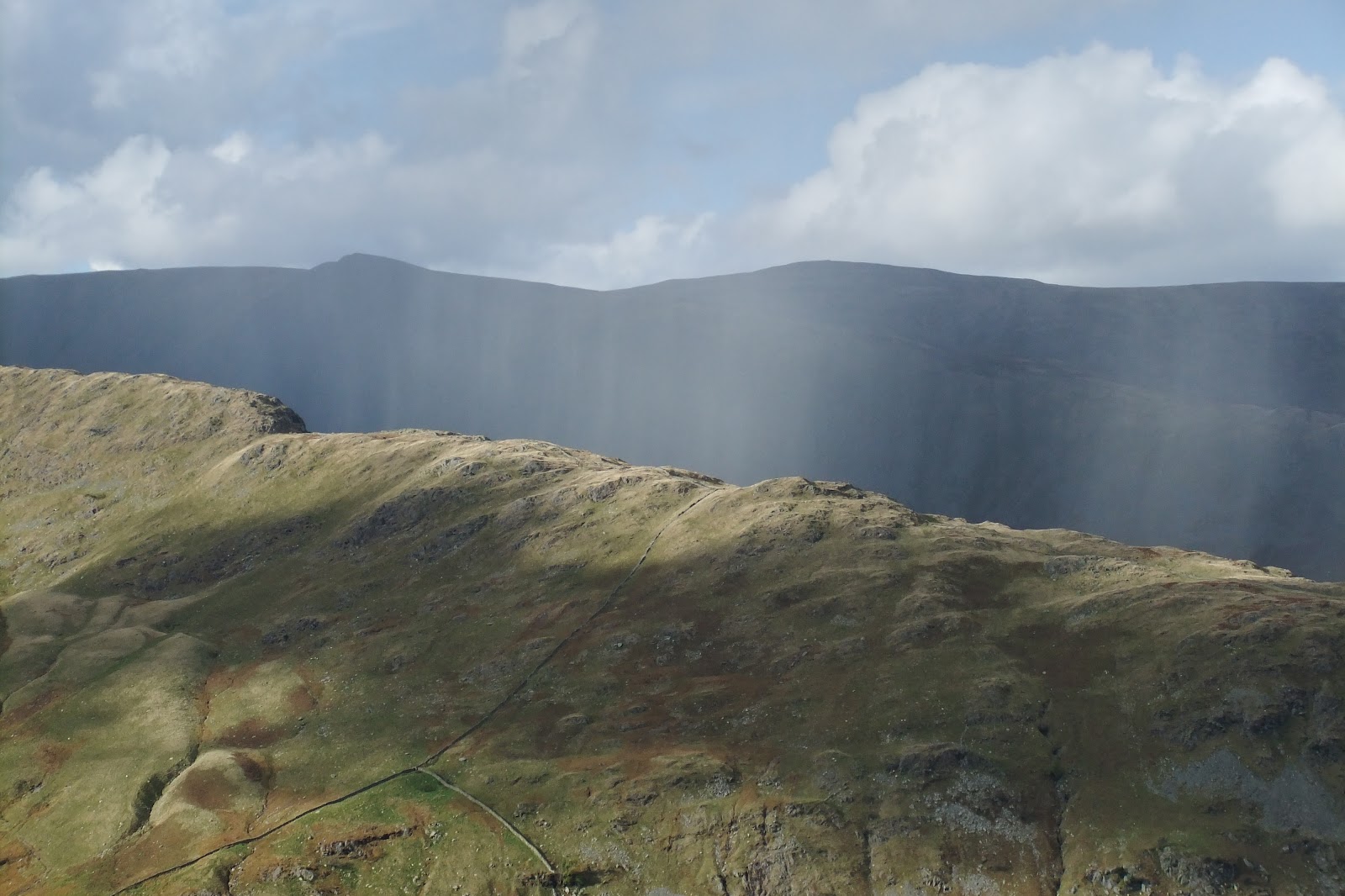
entrance and the Water Cut on Lady Anne’s Highway in the distance. The Nab of Wild Boar Fell was clearly visible as was a drift of smoke from a bonfire somewhere near Outhgill. Sheep were being rounded up on the High Seat side, the voices of the farmers carrying in the windless air. An excellent spot to see the extent, and beauty, of Mallerstang without expending too much energy on elevation!

I continued down Birkett Common to join the bridleway back to Lammerside discovering that this was where all the sheep were hiding. 

Birkett Common & the River Eden
Perhaps they were the next to be rounded up? I continued back to Mire Cross Bridge but carried straight on, passing the huge Wharton Hall Farm with its ruined gatehouse and on to Halfpenny House.
Wharton Hall gatehouse
Glancing back, I took my final look at this desolate but beautiful dale. Finally it was all downhill to home where the lure of a cup of tea was spurring me on. 

I had had my Mallerstang fix and had not been disappointed!  

Wednesday 17 October 2012

Monochrome

Monochrome

I love the autumn. The fresh greens of spring and summer have given way to the hues of a technicolour mantle. In afternoon sunshine, bronzed brackens give fellsides a cosy, comforting glow. Trees and hedgerows display abundant clusters of scarlet berries. The occasional rainbow gives colour to an otherwise darkened hillside. Tarns and lakes mirror their beautiful surroundings. It's the last hurrah before the clocks are turned back and the walking day is shortened. 

On our most recent walk, we came across photographers who had had to wait for mist to clear and colours to reveal themselves. Despite the colours all around us, the light and weather can contrive to give us a reduced palette. In many respects, it simplifies our surroundings and enables us to reflect upon the beauty of structures in the landscape.

Nine Standards Rigg

The Nine Standards cairns draw the viewer in to the slight rise beyond, and the structure silhouetted on the horizon. In the same way that a good novel becomes a 'page-turner', so the cairns encourage us to satisfy our curiosity to explore further.

Harter Fell

Close up, the cairn on top of Harter Fell is a sprawl of stone and rusty fencing, long since dispensed with. With diffused light behind it, we were able to appreciate the cone. (No, it wasn't a saw wedged in on top!)

Selside Pike
I was stunned when I came across this view on Selside Pike the other day. A simple fence junction and excess wire wound round and hung up. Silhouetted against the sky, it was suddenly transformed to a structure of beauty. A place far from the 'madding crowds'. A lonely place perhaps, but a much welcomed landmark to guide the walker down from the hill in adverse weather.

Place Fell
  Rugged?      Wild?      Scary?    Forbidding?    Cold?      Height?       Space?    Loneliness?

Beacon?      Achievement?      Endurance?      Hope?       Stability?    Strength? 

Many thoughts come to mind when looking at this triangulation column on Place Fell. It depends upon your viewpoint. Seeing it in relief against white cloud, allowed us to enjoy its splendid isolation.

'Colours let us off lightly; black and white forces us to think.'

Even in the middle of a glorious autumn afternoon, an atmospheric viewpoint might be waiting to be discovered on the hillside. I love seeing a depiction of a structure on an OS map and discovering it on the hills as we navigate our way around.

Whilst we might have read about structures in guide books, there is nothing quite like seeing it for ourselves.

Tuesday 16 October 2012

Selside Pike & Branstree

Selside Pike & Branstree

 As  usual, we had consulted the MWIS website and the forecast was favourable. Whilst the legs may have appreciated a rest day, the forecast was not looking good for the remainder of the week. The plan had been to start from Swindale Head, but parking was not permitted there. After a quick rethink, we decided to start our walk from the Mardale end of an Old Corpse Road. This was the first time that we had knowingly followed a corpse road whilst walking in the Lake District. In the Yorkshire Dales National Park we have walked along parts of ancient corpse roads.
Mardale Old Corpse Road
Having struggled up some of the routes that are today no more than tiny footpaths, I've often wondered how our ancestors could have carried a body over steep and often inhospitable landscape to consecrated ground.
Rowantreethwaite Beck waterfall
The start of this Old Corpse Road did not disappoint. There was no gentle loosening of the limbs - we zig-zagged our way up a steep fellside immediately. We met a couple of photographers coming down who jokingly threatened to confiscate our cameras. (They had spent three hours, they said, waiting for the cloud to clear.) With cameras intact, we had glorious views over Haweswater and the High Street ridge beyond and snapped away. A case, perhaps, of the early bird not always catching the worm! To our right, was the impressive gully housing Rowantreethwaite Beck, but we were heading onwards and upwards. Two roofless buildings added interest to our walk up until the ground flattened out.

High Street from the Old Corpse Road
From here, it was a gentle and often squelchy walk up to just beyond the highest point on grassland fellside. Tributaries that merged to form Rowantreethwaite Beck could be clearly seen to our right.
Old Corpse Road

Eventually, we reached a broad ridge sloping down from our right. From a wooden post on the corpse road, a muddy, grassy route visible up the hillside. We took a bearing anyway. As we started to walk up, we had a view down Swindale. It was wet, but half an our later we reached the corner of two fences. We had arrived at the summit of Selside Pike.
Selside Pike cairn - 655m
There were wide-ranging views including to the Northern Pennines and Penrith far in the distance. We had our coffee break at the cairn, which also doubled as a windshelter. Our route followed the fence on our left. We quickly lost height and negotiated a couple of peaty sections without difficulty. With good visibility, our next objective was clear. As we climbed up again, we noticed a strange looking pillar over the fence. (It seems this was a survey post remaining from the days when the reservoir was built.) Above us, on the horizon, were the two cairns that we were heading for a little way away from the fence. Clearly, others had deviated away from the fence to visit them too. We were at the rocky Artle Crag. Stones often appeared like shards balanced on their edges embedded in the ground. We had to watch our feet.
Artle Crag cairns
The summit wasn't much further up the fellside. A grassy path led us up to the highest point on Branstree. It was slightly underwhelming. A very small cairn and a circular concrete trig point sunk into the ground marked the spot. We didn't feel inclined to stop for our picnic here. Just behind the trig point was a wall and fence junction. We could have followed the fence straight down the hillside, however we decided to cross the stile and follow the wall down over Selside Brow. Once more, we were treated to a view of Morecombe Bay!
Stile on Branstree - 713m
We made rapid progress down the fellside and were soon at a farm gate which would give access to the Mosedale bridleway. Originally, we thought that we might head down Mosedale to Swindale Head and retake the Old Corpse Road back to our starting point. However, with sunset given as 18:10 and looking at the distance yet to walk, we erred on the side of caution. We took a bearing and headed off in the direction of Gatescarth Pass, with the aim of not losing any more height. 
Selside Brow to Mosedale bridleway
It was reedy, wet and hardgoing underfoot and we had 70 metres of ascent to make. We got the impression that the sheep didn't get too many visitors here. Small, hidden watercourses added to the adventure of this kilometre of 'off piste' walking. As we made our way upwards, we could see a couple walking down the footpath from Harter Fell.
Contouring round to Gatescarth Pass
It wasn't long before we made 'terra firma', and a farm gate on Gatescarth Pass. We could put the map away now. We were on known territory.

Farm gate across Gatescarth byway
We found a suitable rock to sit on and enjoy our picnic. Apart from the beautiful views across to the High Street range, the weather contrived to add to the beauty of the moment. No sooner than we had started on our picnic, but 'stuff' was falling from the sky. Rain? The forecast had suggested wet snow over the highest of the lakeland fells over 900 metres, but we weren't that high up. The fells opposite had gone into dark relief. AB was sporting a glistening look on his fleece. Hail! Nothing heavy - just gentle, light hail. It looked lovely against the darkening background. The camera couldn't pick up the beauty. No sooner had I extracted my jacket from my rucksack and put it on, the hail stopped. We had made a good decision to give Mosedale a miss on this occasion!
Passing rainshower
Picnic finished, we headed back down to Mardale Head. We watched as a rain shower passed by, like a curtain, over Haweswater in the distance. A rainbow added more colour to an autumnal fellside.
Seen walking down Gatescarth byway
We completed our walk, making quick progress along the Haweswater road back to our starting point. Sadly, the western lakeside permissive pathway had been closed, but we were able to enjoy the many watercourses that were flowing down the fellside to drain into the reservoir. The water was running beautifully clear. 

Although this walk had been relatively featureless, it had not been as demanding as the previous day's walk. We'd been fortunate enough to be able to make the most of the good weather and walked up another two Wainwrights. It had given us wonderful views of the High Street ridge and as far afield as the Howgills, Pennines and the sea. We had passed only three people all day. 

Priceless.


High Street Circular

High Street Circular

7 Miles

No, I don't mean Next or Topshop... in fact even the thought of the average high street makes me shudder. A place only to be ventured into through absolute necessity, the expedition having been postponed until the last moment. Far too many people. No, the High Street I was looking forward to lay above Haweswater. The walk had been undertaken by a contributor to a Cumbrian magazine. The forecast was good, so, having consulted the OS map, we decided to try it out for ourselves. Moreover, it would enable us to take in three Wainwrights! Our starting point was Mardale Head. There were over 50 cars parked, but it was a weekend and the tops were clear, so it was hardly surprising that lots of people would be about. (However, so many fewer than a car park serving the average high street.)

Taking the western lakeside path to The Rigg, we were brought to the ridge that buttressed High Street. Initially, the path rose steeply and we gained height quickly. After 500 metres or so, the gradient lessened. We had wonderful views all around: looking down on Haweswater, Kidsty Pike and Harter Fell. We headed onwards and upwards towards the pimple-like cairn on the skyline above us. The path undulated along the rocky and grassy path. To my surprise, we passed several people. Fitness levels must be improving! Eventually, the classic teardrop-shaped Blea Water came into view - beautiful and still. At Caspel Gate, we passed a small tarn to our left. Craggy ground had given way to grassland and a way down to Blea Water was an option, but it wasn't our objective on this occasion. To our right, we had a super view down Riggindale Beck. The imposing steeper ground of Long Stile rose above us.

Long Stile
The map was put away to enable us to use our hands to scramble up the rocky path where necessary. We paused every now and again to soak up the views and look down the ridge we had already walked up. It seemed that quite a few people were walking up the ridge today. The last few metres of the climb up to the cairn was a wide, steep path covered with loose stone.
Blea Water from Long Stile
It was a mere 200 metres or so south to the trig point, which stood next to a low wall. It had taken us just two hours.
High Street trig point - 828m
After the usual photographs, we found a good spot for our coffee break next to the ground- level remains of what had probably once been a bothy . The top here was broad and flat. You could imagine horses being raced up here. (High Street - otherwise known as Racecourse Hill) There were wonderful views all round and our next destination was clear in superb visibility. There was no wind. Most surprising was the view of Morecombe Bay.

Ill Bell with Morecombe Bay in the distance
We headed off south-eastly and joined a clear path to our next Wainwright - Mardale Ill Bell. It was a gentle down and up to the prominent summit cairn. It was surrounded by rocks which gave the appearance of standing on end. We dropped down just below the cairn to a sheltered, sunny spot for our lunch. We were able to enjoy good views of Harter Fell and contemplate the next part of our walk, which was clear.
Mardale Ill Bell cairn - 760m

We followed a rocky, steeper path quickly down to Nan Bield Pass. A substantial wind shelter was located here. Had we wished to cut our walk short, or needed an escape route, we could have quickly dropped down back to Mardale Head from here. 

Wind shelter at Nan Bield Pass


As the weather was still fine, we continued up a rocky ridge to the summit cairn on Harter Fell. On the way we had a brillant view of Small Water which had eluded us earlier.
Small Water from Harter Fell ridge
Before long, we reached the small high point of Harter Fell. Broken, rusting, fencing was incorporated into the summit cairn.    
Summit cairn - Harter Fell - 778m

A fence, with a stile, carved up the summit. Staying on the cairn side of the fence, it was a gentle descent along the fence to twin cairns. These were similarly 'adorned' with ironwork. Our well-defined route followed the fence until it joined the Gatescarth Pass at a gate. We turned downwards. The rocky and uneven byway was clear, and views of the ridge we had climbed earlier in the day was illuminated in the afternoon sunshine. The byway was quite steep at times and it was important to watch where we planted our feet as we picked our way over loose stones. Gatescarth Beck, running parallel to the byway, provided a watery, musical accompaniment on our descent. Very soon we were back at Mardale Head.

The car park had cleared somewhat. Whilst a lot of people had been out walking, at no time had we felt crowded out on the fells. This had been a High Street walk that I'd happily return to.


Saturday 13 October 2012

Beda Fell & Place Fell

Beda Fell & Place Fell

7.5 miles

This walk started from the base of Hallin Fell, just beyond Howtown in the Lake District National Park. Rain had fallen overnight, but the forecast had suggested that there would be good visibility with perhaps an isolated shower. Buffeting, from the wind on the tops, could be expected. As we walked down the minor road to Winter Crag Farmhouse, the tops of our objectives were clear of cloud.

Beda Fell


Just beyond the farmhouse, we left the road to follow a footpath through bracken up the fellside. For a time we had a wall on our right. It was a short pull up onto the ridge near Winter Crag. We caught our first sighting of Ullswater from here; a favourite viewpoint for someone, as a metal bench had been installed. No time to linger. We turned south to follow a mostly clear path up through a series of rocky outcrops and rough fellside vegetation. The higher we climbed, the more blustery it became. It was worth turning round to look back down the path. Extensive views of Ullswater, punctuated by Hallin Fell, opened up to us. It wasn't long before we reached the first cairn and then the modest summit cairn of Beda Head.


Cairn on approach to Beda Head

On the eastern side of the summit cairn we were able to drop down four or five feet to gain some shelter from the wind which was considerable. Whilst we had our coffee fix, Steel Knotts, Gowk Hill, and beyond that, the massive ridge of High Street lay before us.  

Beda Head Summit cairn

We continued along the ridge, soon losing height. It was a little squelchy and the vegetation along the path was thin at times, so we needed to be careful where we trod.  We could see the hause that we were headed for. Eventually, the ground began to rise (and fall), until we reached a judicially placed cairn. This marked the bridleway between Dale Head and Boredale Hause.

Bridleway cairn

Our route was no wider than a sheep track at times, but the way was clear. We crossed a narrow beck and, before long, the wide open expanse of Boredale Hause opened up to us. Paths seemed to extend out in all directions. Over to our right, we were able to look down Boredale with Hallin Fell at its far end. Further on, to our left, we could see a clear path that formed part of Wainwright's Coast to Coast walk. Our route was clear - a broad, steep path winding its way up north of the hause. 

Place Fell

To save losing height, we left the bridleway and contoured round over rough ground to join the footpath up Place Fell. Fortunately, at some of the steeper parts, conservation work had been undertaken and rocky steps had been installed. As we walked up, we had amazing views of Patterdale with St. Sunday Crag, Birkhouse Moor, and Sheffield Pike dominating behind. The neat, lush green of Patterdale's cricket ground could be seen. (Two years previously we had admired the ground as we'd descended from St. Sunday Crag.)


Path on Place Fell
Turning round towards the south, shafts of sunlight illuminated Hartsop and Brothers Water.
Beautiful.
Brothers Water from Place Fell

It wasn't long before we came to a prominant cairn and, for a few hundred metres, the ground flattened out before rising to a craggy top. With quite a lot of water about, we were careful where we trod. Once more, there was considerable buffeting from the wind and a significant wind chill.

Place Fell summit and trig point.
With care, we reached the trig point, but it was too blustery to linger. There were fabulous views all round. We dropped down to the east side of the trig point to find relative shelter from the wind. Lunchstop. A large tarn below us was patterned by gusts of wind blowing the surface water. Directly in front of us was Beda Fell. Lunch was a relatively quick affair as fingers were chilled. A clear, muddy and rocky footpath (very slippery) eventually turned into a green swarth and our progress quickened. This too eventually narrowed to no more than a sheep track in places. From the right, a steep path up from Boredale joined the footpath we were on. Hallin Fell and Ullswater looked glorious in the afternoon sunshine. It was a steep descent to the edge of access land and a minor road which served Sandwick. 


Easier walking
Turning right, we walked for just 100 metres or so before taking a footpath and crossing Sandwick Beck via a bridge at Bridge End Farm. The footpath passed through farmland which skirted the base of Hallin Fell. 
Footbridge at Bridge End Farm


Beda Fell was basking in sunshine. All too soon our walk was complete. Should we nip up Hallin Fell too? It was tempting, but the legs might not have thanked me for it.

It was a fantastic walk with great views. The beauty of the countryside is sometimes hard to convey. Photographs can only be an aide memoir, as our response to our surroundings cannot be captured. I guess the best way to rate a walk is to ask the question," Would we walk it again?"

Absolutely.


Sunday 7 October 2012

Murton Pike & High Cup Nick

Murton Pike & High Cup Nick

9 Miles

Well I'll admit it. I was rather grumpy as we parked up in Dufton. As we had driven along the A66, cars had had their headlights on and the Northern Pennines were shrouded in mist. There were no hills. What was the point? A friend had told us that we would need good visibility to get the full effect.The forecast was for a good day with the sun burning off the mist, but it hadn't happened. We started up the car again and crept along the tiny minor road (with the occasional passing place)  to Murton. As we drove along, there was evidence of the mist starting to clear. In Murton, we turned left up the fell road which ended in a car park. Murton Pike was just about clear of mist by this time. After consulting the map, we decided to walk up Murton Pike and reassess the situation from there.

Murton Crag

Although there was a good track up Murton Pike, we didn't take it initially as we followed a grassy swarth. It was a steady climb. We rejoined the track just under a sunlit Murton Crag. Continuing upwards, the track ran parallel with Gasdale for a time, giving wonderful views of Mell Fell. The bowl-like fellside of Gasdale Head lay ahead. We left the track at a col and headed off in a WSW direction along a grassy footpath (not marked on an OS map) to Murton Pike. From this side, it looked like a classical conical mountain top. Footholes in the fellside acted as steps where the ground steepened. It wasn't long before we reached the white painted triangulation column.

The moon over Murton Pike
What a view! The Eden valley was laid out like a carpet before us, beautifully green. At the foot of the Pike was Murton village, with Hilton over to our left. The fairways of Appleby Golf Course could be seen clearly. To our right, was Dufton and its Pike. In the distance was the distinctive shape of Wild Boar Fell, the Howgills and Lakeland. We sat a while enjoying a coffee and the panorama in front of us. As the tops were now clear of mist, we decided to continue on to High Cup Nick having consulted our map to find a route. Visibility was excellent and it was clear where we needed to head for.

We retraced our steps down from the Pike and rejoined the track towards the high ground on the edge of Burnt Crag. The whole area was peppered with shake holes. At a fork, we left the permissive track and took a signposted grassy bridleway. It was a little squelchy underfoot. We passed small stone cairn / shelters as we headed north. The bridleway became no more than a narrow grassy footpath as it descended into Trundale Gill near a wall junction.
Trundale Gill

It was easy crossing here and we followed another narrow footpath up the other side towards the wall. The bridleway was waymarked with posts at intervals, although amongst the vegetation and piles of stones it was indistinct on the ground. We chose to follow the wall and head towards a large stone cairn like many had clearly done before us. Heading in a generally NE direction, we followed the line of bridleway markers along squelchy fellside. (Not marked on an OS map) To our left, the ground fell away and we could see the path that would be our return route. We got our first views of the steep-sided High Cup Nick. The sun accentuated the folds punctuated by streams. As a plateau of fellside widened below us, we left the bridleway and headed down beside a stream to join a clear, grassy path.

Heading down towards High Cupgill Head
Turning right, we made our way to High Cupgill Head and crossed the shallow stream via the stones. Walkers on the Pennine Way would cross this stream. To our surprise, we were alone.

Stream at High Cupgill Head
The drama of this geographical feature could not be exaggerated. A wonder of the natural world. Photographs could never do it justice. The sun was shining directly up it, making the meanders of High Cup Beck far below us seem like a silver snake.

View down High Cup Gill
It was a perfect lunchstop. Behind us lay miles of lonely moorland.
High Cup Scar
 Eventually, others wandered up the Narrow Gate path. It was time to leave.


Nichol Chair
We crossed over the stream again and rejoined the clear and squelchy, grassy footpath. (marked on OS map) It passed very close to the top of the very steep crags of High Cup Scar at times. The path started heading gently upwards, past a small, tumbledown, stone building before reaching a wall and a sturdy ladder stile.

Stile on path to Middle Tongue

As we descended Middle Tongue, Murton Pike towered impressively. Our route skirted underneath the southern elevation of Middletongue Crag. We had to cross a small stream before passing through a farm gate that marked the edge of Access land.

Murton Pike from Middle Tongue
It was just a short walk up a farm track to a farm at Harbour Flatt. After turning right through the farmyard, it was just 200m to the minor road that we had driven along earlier. Only one vehicle passed us as we walked the short distance along it into Murton. Haws and hips brightened the hedgerows and looked stunning in the afternoon sun.

Hawthorn & Murton Pike
The forecast had been right. We had enjoyed good visibility, sunshine, blue skies and minimal wind. The original plan had been a circular walk from Dufton around both sides of High Cup Nick. Thanks to the delay in the mist lifting, we were able to visit two of our many objectives. Today's walk had exceeded all our expectations. Thank you, Celia.


Friday 5 October 2012

Blowing the Cobwebs Away

Blowing the Cobwebs Away

For one reason or another, it's been a little while since our last walk. The weather has certainly conspired against us. We had sat and watched raindrops chasing down the windowpanes and a river whooshing down the road, but finally the rain had stopped and the sun was shining. Time to get the boots on.

We started off along our favourite Eden Valley Viaduct walk. The rain of the previous days had washed the top surface of the cinder type pathway away in places, but that came as no surprise given the amount of water that had fallen from leaden skies. It was lovely walking along with the sun filtering through the trees. In no time at all we had crossed the two viaducts and joined the minor road which climbed round Hartley Quarry. Here, the road steepened and we quickly gained height. Kirkby Stephen looked lovely, nestling down below. The Northern Pennines and the Howgills were sunning themselves. The view is never disappointing. Onwards and upwards. We passed the farm with the llamas in the field and very soon reached the wooden chair on access land. After a quick slurp of water whilst enjoying the ever widening panorama, we were off again.

Our tick-off features were soon reached...
  • the tiny stretch of duckboarding
  • the wide green swarth
  • the high banked section
  • the broken barn in the wall
  • the finger post
  • the sheepfold
  • the stone chair
  • Faraday Gill
Needless to say, it came as no surprise to find the route wet, but we did wonder how sloppy it would get further up near to the summit. We came to the little wooden plank bridge. Judicially placed stones enabled us to step onto the bridge. As you can see, there was quite a bit of water lying on the path the other side of it too.
Not far to go. Not too bad. 
Passed the first set of redundant, wooden 'risers', and then a thinner, second set (equally redundant). The worst section of the path by far is that part just short of the summit. It was a veritable quagmire. Black, oozy peat. It was a case of crossing it the best way that you could.

The cairns on top of Nine Standards Rigg stood alone. Normally, there are several people atop enjoying the views or taking a rest before continuing on their way either back into the Upper Eden Valley, or onwards to Swaledale. It was wonderful to have the summit all to ourselves. We selected a cairn with a horizontal 'shelf' seat around it and ate our lunch on the sheltered side. Visibility was very good and we could make out white industrial buildings way over to the east on the other side of the Pennines. From the direction of the firing ranges near Warcop, the crump and boom of firing could be heard. Other than that, it was just the sound of the breeze.


Fluffy clouds framed the view of the Upper Eden Valley. Over to the north on the fellside of Nine Standards, a farm vehicle deposited a group with dogs. Were they assessing the ground for grouse? Were they checking on sheep? We wouldn't find out. It started to grow colder and we donned our outer shell before making our way to the viewfinder. The sky had clouded over and making its way across the Howgills and Orton fells was raincloud. It was coming our way. It's always tempting to think that you're 'Only just going up there', so you don't need to pack so much in the rucksack. Fortunately, we've always packed for any weather, and today was no different.

Our descent to the wooden chair and the tarmac road was reasonably quick. We passed just two lone walkers, one with a dog, who were heading upwards. Somewhere below us, was the whine of a chainsaw. These three beauties posed for us. Would they be rounded up later to be pampered, shown and sold at one of the big sales nearby? By now it was starting to rain.

We're becoming accustomed to the sudden and generous lashings of rain that give Upper Eden a verdant appearance. Often shortlived, but sometimes prolonged rain seems to fall in so many guises. We need a whole new vocabulary to describe the nuances of rain. This was wetting. We made rapid progress along the minor road that served probably a couple of farms. The llamas chewed their grass and looked superior. White smoke still billowed from the quarry. The rooftops of Kirkby Stephen glistened. Abundant, scarlet berries bejewelled the trees.

We turned onto the viaduct walk. Overhanging trees dripped, but sheltered us from the worst of the rain which was starting to abate. 

Refreshed and renewed, it seems there's always something new on this increasingly familiar walk.