Showing posts with label Wainwrights. Show all posts

Friday, 30 November 2012

Freezing

 Freezing

Ice sculptures are often commissioned at great expense to give an event a 'wow' factor. For most of us though, the good old ice cube tray and, weather permitting, snowman building is probably the extent of our dabbling with ice. I seem to recollect that one of our cookery books, of a certain vintage, detailed how to make an ice bowl from which to serve that 1980s classic... the prawn cocktail. (I never tried it.) So it was fantastic to come across some wonderful natural 'sculptures' when we were out walking on a sunny, blue-skied day right at the end of November.

There had been a hard frost and we came across this puddle at the verge of a farm track. The top layer was quite white and still, but underneath the surface there were spiral channels of trickling water around the stones on the track's surface. 
 
Puddle
As we left the bridleway to start our climb up the fellside, we noticed these icicles tucked underneath overhanging rough grasses. These were the first that we had seen this winter. How long they had taken to form was anyone's guess, but they were beautiful as they clung on to their grassy host.
Crystal clear
Simple, agricultural wire fencing provided a structure for snow and ice too. Bending down, it was like peering through cottage style casement windows. Each 'window' provided its own view. Earlier on we had seen small, regular shapes of ice lying at the bottom of the fence as if the 'windows' had been shattered.

Further up, the snow and ice had remained intact and made for a very impressive sight. Here, the snow had also drifted into ridges emanating from the fence. The contrast of shadow and glistening snow was spectacular. In the sun, the snow sparkled as if it had had a sprinkling of glitter on it. Magical.

The triangulation pillar had also taken on a new guise with sculpted sides.


Triangulation Pillar - Skiddaw
The summit of Skiddaw Little Man was graced with a magnificent sculpture thanks to mother nature and some twisted metal. With the sun behind it, it had natural illumination. It was the ideal place to stop for our lunch and contemplate nature's beauty.
Skiddaw Little Man - summit
Earlier in the day the melody and words of Harold Darke's, 'In the bleak mid winter,' had come to mind as the ground crunched underneath our feet. But, as the icy artwork kept emerging, this day had been anything but bleak.


Tuesday, 27 November 2012

Silver How, Blea Rigg & Tarn Crag

Silver How, Blea Rigg & Tarn Crag

The lure of three Wainwrights was more than enough to get us out on this rambler's walk starting from Grasmere. A real bonus was to park for free half a mile outside of Grasmere. The ridge we were to walk was clear as we set off in cloudy, but dry weather, though behind us, the tops of Fairfield and Seat Sandal were shrouded in cloud. The forecast was reasonable with improving conditions to look forward to.

We skirted Grasmere and went across the Easedale Road before heading up footpaths to the cairn at the top of Silver How. At 395 metres, this was not a high Wainwright, but the views over Grasmere to Rydal Water were stunning.
Grasmere & Rydal Water from Silver How
 Behind us, in autumn colour, was Helm Crag and ahead Pavey Ark loomed large. After a coffee break admiring the views, it was off across an undulating and, at times, wet landscape.

The next target was Blea Rigg at 541 metres, about two miles away. We crossed Brigstone Moss, climbed Long How and Swinescar Pike, from where there were excellent views of Langdale with Crinkle Crags and Bowfell in the background. The recent rain had made it a very green valley. Passing a tarn, it was not long before we reached Blea Rigg, overlooking Easedale Tarn to the north and Elterwater to the south east. This was to be the lunchspot, another superb vista to photograph and post on Facebook as...'Today's lunchtime view.' The large rocks on the rigg made excellent seats, but we were soon off again to our third high point.
Langdale PIkes from Blea Rigg
 With Pavey Ark immediately in front of us, we headed north and after crossing a boggy patch descended steeply around Eagle Crag (How many Eagle Crags are there?), before rising again to Codale Tarn. We had had views of this tarn from an elevated position when we did a wild camp in April.From the shores of the tarn, we could see why we didn't drop down to it on that occasion. It would have been a steep ascent at the start of the next day! Today though, we skirted the tarn, which was quiet and still, before beginning the final climb to Tarn Crag. 
Easedale Tarn

At 550 metres, this was the highest point of the day. We picked out the Calf Crag, Gibson Knott, Helm Crag ridge we had walked on the Coast to Coast walk in 2010. The views down to Grasmere over Easedale Tarn were also very impressive.

Looking back to Tarn Crag
 Our route back was clear to see from the top and it was all down hill to join the Easedale bridleway. From here it was an easy walk back to the outskirts of Grasmere and retrace our steps skirting this popular tourist spot. On returning to the car, it was easy to see the route we had been on, and excellent ridge walk with glorious views.

AND... three Wainwrights bagged!

Tuesday, 20 November 2012

Bowscale Fell

Bowscale Fell

Distance: 6 Miles

Highest Point: 702m

The forecast, always a consideration for any walking destination, seemed to suggest that it would be dry. We parked up in the 'Township' of Bowscale and set off up a good bridleway on access land. It was a gradual up. Although a little cloudy, visibility was good and patches of sunlight illuminated farmhouses in the valley and the steep-sided Carrock Fell.
Soon the route steepened, as the bridleway climbed the fellside. We crossed over Drycomb Beck without difficulty and continued upwards. A wall of crags appeared in front of us and we scanned the scene to pick out where our footpath would take us. As with all fine views, the glacial Bowscale Tarn lay hidden in a bowl until we were almost upon it. We had been brought to the 'teardrop' top where Tarn Sike was emptying the tarn. Not another soul was about. The breeze was gently rippling the tarn's surface. A large boulder sat begging to be sat upon, and we duly obliged it. A great spot for a photo and to break open the flask for a warming slurp of coffee. It was a little nippy.
FP from Bowscale Tarn

We didn't linger too long, having spotted a small path that snaked its way up Tarn Crags towards the horizon. This was our route. We crossed Tarn Sike and made our way up the path that Wainwright called a 'grassy rake'. It was quite steep and in places I was pleased to be able to use my hands for a little extra security when the path looked a little slippery.

Bowscale Tarn
The higher we climbed, the more impressive the tarn below us seemed. The water appeared as a fine blue and the 'teardrop' was clear in the hillside vessel. Very soon we were at the rim of Tarn Crags. We headed south, following the edge of the crags before joining a clear track up the rounded ridge to a pile of stones that marked the edge of the Bowscale Fell summit plateau. I think it would be fair to say that it felt a little 'baltic', and we lost no time in putting on gloves and pulling our hats down a little further over the ears. We made our way the short distance to the summit, a low, 'C' shaped windshelter, passing a couple of chaps on the way. The thought was there, even if it was rather ineffective. We paused for photographs and continued along the ridge towards Bannerdale Crags to seek a suitable lunchspot.
Bowscale Fell summit wind shelter
We continued past the ridge (on our left) that would lead to The Tongue, and joined a footpath at NY334302 that would take us down into Bannerdale. Several people were out on the ridge, taking advantage of a fine day.
Towards Bannerdale Crags with Blencathra rising up in the distance

The footpath was clear and we soon stopped for our lunch with a good view of Souther Fell and Bannerdale Crags and the valley below. It was still chilly, but at least there was less wind and the sun was shining.
Bannerdale & Souther Fell
From here, it was all downhill. We had fine views and the pathway took us gently down into the valley. A footbridge at NY356302 enabled us to cross a watercourse, and from then on we had the River Glenderamackin on our right.

The Tongue
It wasn't long before we reached the village of Mungrisdale and passed the still functioning phone box. I don't think our walking boots were going to trouble any shy, red squirrels, but there were none to be seen on this occasion.
Sign at Mungrisdale
After a quick circulation of the village, we headed back along the road to Bowscale. (The only road walking of the day.) The sun was already low in the sky, and it wouldn't be long before it would be setting.

Here we were in mid November, and we had had a wonderful walk. Our companions for the day, AJ & SE, had really enjoyed the change of scenery and 'fresh' air.


Fellbarrow & Low Fell Circular

Fellbarrow & Low Fell Circular

Although the forecast was not too promising with wind and squally showers predicted, we made our way to park at Maggie's Bridge (free!) close to Loweswater. This ramblers walk, undertaken in August, was our first with a new group of people. The route was to take us around the south side of Loweswater and then up to Fellbarrow and Low Fell north of the lake... two Wainwright's to collect.

Loweswater
On the level path around the lake, the weather was improving and the sun began to put in some appearances. We soon reached the road at Waterend before turning left up Grange Lane, the first climb of the day. (Off with the top layer) We joined the bridleway around the west side of Fellbarrow and stopped for a coffee break. 
Footpath around Loweswater
Next, it was up and across access land over Mosser Fell to a wall junction before heading straight to the trig point at the top of Fellbarrow. The height here was 416m with views to Cockermouth, The Solway Firth and beyond.

Our next target, Low Fell, was some mile and a half south. Following the ridge wall up and over both Smithy Fell and Sourfoot Fell, we soon came to the cairn at 423m... the highest point. The wind was pretty strong, so we dropped down out of it and had lunch with superb views over Lorton Vale towards Grasmoor. To our right, Crummock Water was now glistening in the sun with Buttermere beyond, and in the distance Haystacks and the Red pike ridge. All too soon it was time to move off.

Low Fell
We walked to the cairn at 412m, the point Wainwright called, 'The Top', and admired the views over Buttermere and Crummock, and also now, back over Loweswater.

Crummock Water from Low Fell
We then descended off the access land to the footpath through Whinny Ridding before meandering through lanes back to the car park.
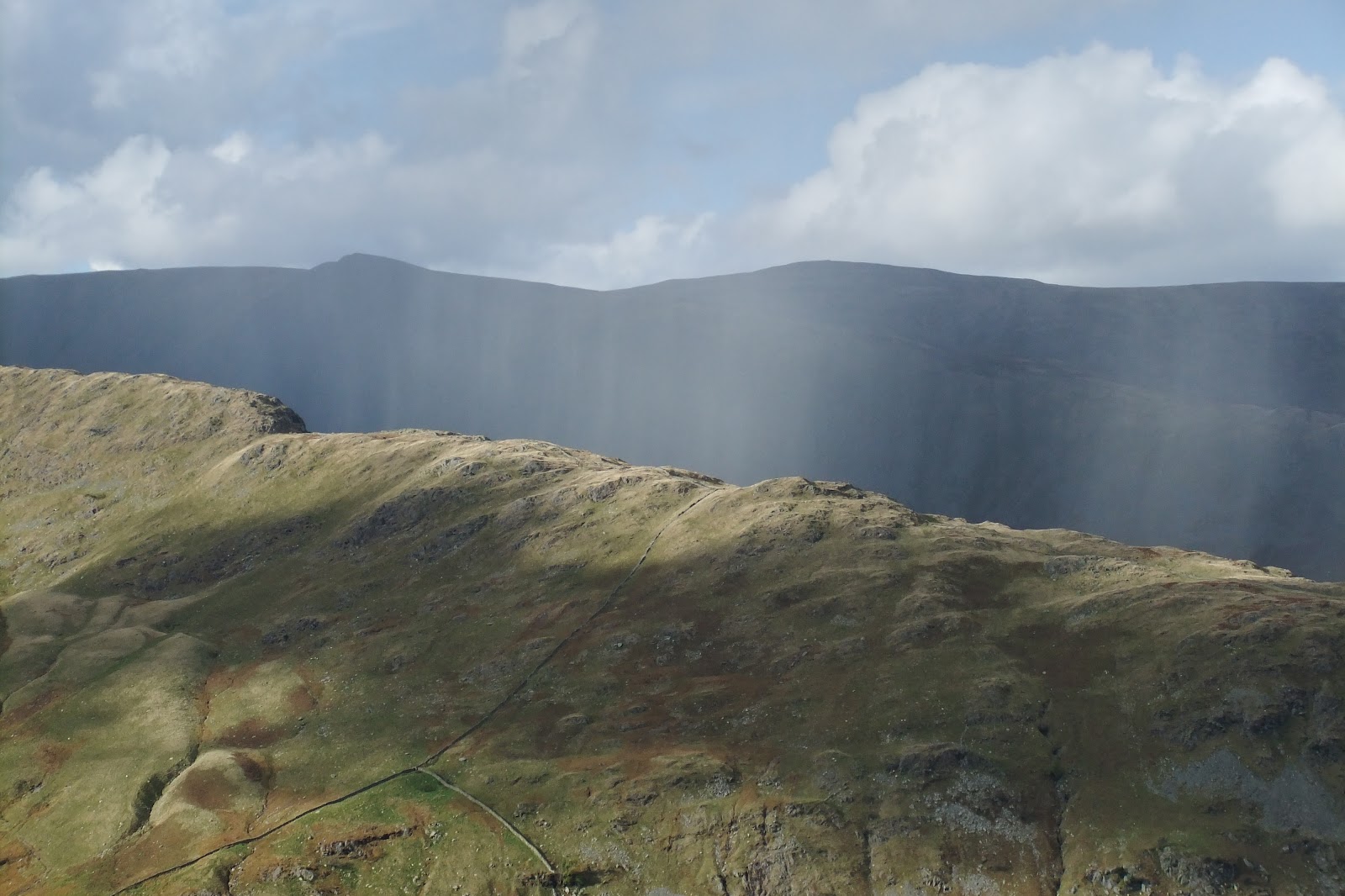
Loweswater Fells
Without gaining tremendous height, we had had a splendid walk with views over the surrounding lakes and fells which were sublime. 

It's a privilege to be able to enjoy them.


Tuesday, 16 October 2012

Selside Pike & Branstree

Selside Pike & Branstree

 As  usual, we had consulted the MWIS website and the forecast was favourable. Whilst the legs may have appreciated a rest day, the forecast was not looking good for the remainder of the week. The plan had been to start from Swindale Head, but parking was not permitted there. After a quick rethink, we decided to start our walk from the Mardale end of an Old Corpse Road. This was the first time that we had knowingly followed a corpse road whilst walking in the Lake District. In the Yorkshire Dales National Park we have walked along parts of ancient corpse roads.
Mardale Old Corpse Road
Having struggled up some of the routes that are today no more than tiny footpaths, I've often wondered how our ancestors could have carried a body over steep and often inhospitable landscape to consecrated ground.
Rowantreethwaite Beck waterfall
The start of this Old Corpse Road did not disappoint. There was no gentle loosening of the limbs - we zig-zagged our way up a steep fellside immediately. We met a couple of photographers coming down who jokingly threatened to confiscate our cameras. (They had spent three hours, they said, waiting for the cloud to clear.) With cameras intact, we had glorious views over Haweswater and the High Street ridge beyond and snapped away. A case, perhaps, of the early bird not always catching the worm! To our right, was the impressive gully housing Rowantreethwaite Beck, but we were heading onwards and upwards. Two roofless buildings added interest to our walk up until the ground flattened out.

High Street from the Old Corpse Road
From here, it was a gentle and often squelchy walk up to just beyond the highest point on grassland fellside. Tributaries that merged to form Rowantreethwaite Beck could be clearly seen to our right.
Old Corpse Road

Eventually, we reached a broad ridge sloping down from our right. From a wooden post on the corpse road, a muddy, grassy route visible up the hillside. We took a bearing anyway. As we started to walk up, we had a view down Swindale. It was wet, but half an our later we reached the corner of two fences. We had arrived at the summit of Selside Pike.
Selside Pike cairn - 655m
There were wide-ranging views including to the Northern Pennines and Penrith far in the distance. We had our coffee break at the cairn, which also doubled as a windshelter. Our route followed the fence on our left. We quickly lost height and negotiated a couple of peaty sections without difficulty. With good visibility, our next objective was clear. As we climbed up again, we noticed a strange looking pillar over the fence. (It seems this was a survey post remaining from the days when the reservoir was built.) Above us, on the horizon, were the two cairns that we were heading for a little way away from the fence. Clearly, others had deviated away from the fence to visit them too. We were at the rocky Artle Crag. Stones often appeared like shards balanced on their edges embedded in the ground. We had to watch our feet.
Artle Crag cairns
The summit wasn't much further up the fellside. A grassy path led us up to the highest point on Branstree. It was slightly underwhelming. A very small cairn and a circular concrete trig point sunk into the ground marked the spot. We didn't feel inclined to stop for our picnic here. Just behind the trig point was a wall and fence junction. We could have followed the fence straight down the hillside, however we decided to cross the stile and follow the wall down over Selside Brow. Once more, we were treated to a view of Morecombe Bay!
Stile on Branstree - 713m
We made rapid progress down the fellside and were soon at a farm gate which would give access to the Mosedale bridleway. Originally, we thought that we might head down Mosedale to Swindale Head and retake the Old Corpse Road back to our starting point. However, with sunset given as 18:10 and looking at the distance yet to walk, we erred on the side of caution. We took a bearing and headed off in the direction of Gatescarth Pass, with the aim of not losing any more height. 
Selside Brow to Mosedale bridleway
It was reedy, wet and hardgoing underfoot and we had 70 metres of ascent to make. We got the impression that the sheep didn't get too many visitors here. Small, hidden watercourses added to the adventure of this kilometre of 'off piste' walking. As we made our way upwards, we could see a couple walking down the footpath from Harter Fell.
Contouring round to Gatescarth Pass
It wasn't long before we made 'terra firma', and a farm gate on Gatescarth Pass. We could put the map away now. We were on known territory.

Farm gate across Gatescarth byway
We found a suitable rock to sit on and enjoy our picnic. Apart from the beautiful views across to the High Street range, the weather contrived to add to the beauty of the moment. No sooner than we had started on our picnic, but 'stuff' was falling from the sky. Rain? The forecast had suggested wet snow over the highest of the lakeland fells over 900 metres, but we weren't that high up. The fells opposite had gone into dark relief. AB was sporting a glistening look on his fleece. Hail! Nothing heavy - just gentle, light hail. It looked lovely against the darkening background. The camera couldn't pick up the beauty. No sooner had I extracted my jacket from my rucksack and put it on, the hail stopped. We had made a good decision to give Mosedale a miss on this occasion!
Passing rainshower
Picnic finished, we headed back down to Mardale Head. We watched as a rain shower passed by, like a curtain, over Haweswater in the distance. A rainbow added more colour to an autumnal fellside.
Seen walking down Gatescarth byway
We completed our walk, making quick progress along the Haweswater road back to our starting point. Sadly, the western lakeside permissive pathway had been closed, but we were able to enjoy the many watercourses that were flowing down the fellside to drain into the reservoir. The water was running beautifully clear. 

Although this walk had been relatively featureless, it had not been as demanding as the previous day's walk. We'd been fortunate enough to be able to make the most of the good weather and walked up another two Wainwrights. It had given us wonderful views of the High Street ridge and as far afield as the Howgills, Pennines and the sea. We had passed only three people all day. 

Priceless.


High Street Circular

High Street Circular

7 Miles

No, I don't mean Next or Topshop... in fact even the thought of the average high street makes me shudder. A place only to be ventured into through absolute necessity, the expedition having been postponed until the last moment. Far too many people. No, the High Street I was looking forward to lay above Haweswater. The walk had been undertaken by a contributor to a Cumbrian magazine. The forecast was good, so, having consulted the OS map, we decided to try it out for ourselves. Moreover, it would enable us to take in three Wainwrights! Our starting point was Mardale Head. There were over 50 cars parked, but it was a weekend and the tops were clear, so it was hardly surprising that lots of people would be about. (However, so many fewer than a car park serving the average high street.)

Taking the western lakeside path to The Rigg, we were brought to the ridge that buttressed High Street. Initially, the path rose steeply and we gained height quickly. After 500 metres or so, the gradient lessened. We had wonderful views all around: looking down on Haweswater, Kidsty Pike and Harter Fell. We headed onwards and upwards towards the pimple-like cairn on the skyline above us. The path undulated along the rocky and grassy path. To my surprise, we passed several people. Fitness levels must be improving! Eventually, the classic teardrop-shaped Blea Water came into view - beautiful and still. At Caspel Gate, we passed a small tarn to our left. Craggy ground had given way to grassland and a way down to Blea Water was an option, but it wasn't our objective on this occasion. To our right, we had a super view down Riggindale Beck. The imposing steeper ground of Long Stile rose above us.

Long Stile
The map was put away to enable us to use our hands to scramble up the rocky path where necessary. We paused every now and again to soak up the views and look down the ridge we had already walked up. It seemed that quite a few people were walking up the ridge today. The last few metres of the climb up to the cairn was a wide, steep path covered with loose stone.
Blea Water from Long Stile
It was a mere 200 metres or so south to the trig point, which stood next to a low wall. It had taken us just two hours.
High Street trig point - 828m
After the usual photographs, we found a good spot for our coffee break next to the ground- level remains of what had probably once been a bothy . The top here was broad and flat. You could imagine horses being raced up here. (High Street - otherwise known as Racecourse Hill) There were wonderful views all round and our next destination was clear in superb visibility. There was no wind. Most surprising was the view of Morecombe Bay.

Ill Bell with Morecombe Bay in the distance
We headed off south-eastly and joined a clear path to our next Wainwright - Mardale Ill Bell. It was a gentle down and up to the prominent summit cairn. It was surrounded by rocks which gave the appearance of standing on end. We dropped down just below the cairn to a sheltered, sunny spot for our lunch. We were able to enjoy good views of Harter Fell and contemplate the next part of our walk, which was clear.
Mardale Ill Bell cairn - 760m

We followed a rocky, steeper path quickly down to Nan Bield Pass. A substantial wind shelter was located here. Had we wished to cut our walk short, or needed an escape route, we could have quickly dropped down back to Mardale Head from here. 

Wind shelter at Nan Bield Pass


As the weather was still fine, we continued up a rocky ridge to the summit cairn on Harter Fell. On the way we had a brillant view of Small Water which had eluded us earlier.
Small Water from Harter Fell ridge
Before long, we reached the small high point of Harter Fell. Broken, rusting, fencing was incorporated into the summit cairn.    
Summit cairn - Harter Fell - 778m

A fence, with a stile, carved up the summit. Staying on the cairn side of the fence, it was a gentle descent along the fence to twin cairns. These were similarly 'adorned' with ironwork. Our well-defined route followed the fence until it joined the Gatescarth Pass at a gate. We turned downwards. The rocky and uneven byway was clear, and views of the ridge we had climbed earlier in the day was illuminated in the afternoon sunshine. The byway was quite steep at times and it was important to watch where we planted our feet as we picked our way over loose stones. Gatescarth Beck, running parallel to the byway, provided a watery, musical accompaniment on our descent. Very soon we were back at Mardale Head.

The car park had cleared somewhat. Whilst a lot of people had been out walking, at no time had we felt crowded out on the fells. This had been a High Street walk that I'd happily return to.


Saturday, 13 October 2012

Beda Fell & Place Fell

Beda Fell & Place Fell

7.5 miles

This walk started from the base of Hallin Fell, just beyond Howtown in the Lake District National Park. Rain had fallen overnight, but the forecast had suggested that there would be good visibility with perhaps an isolated shower. Buffeting, from the wind on the tops, could be expected. As we walked down the minor road to Winter Crag Farmhouse, the tops of our objectives were clear of cloud.

Beda Fell


Just beyond the farmhouse, we left the road to follow a footpath through bracken up the fellside. For a time we had a wall on our right. It was a short pull up onto the ridge near Winter Crag. We caught our first sighting of Ullswater from here; a favourite viewpoint for someone, as a metal bench had been installed. No time to linger. We turned south to follow a mostly clear path up through a series of rocky outcrops and rough fellside vegetation. The higher we climbed, the more blustery it became. It was worth turning round to look back down the path. Extensive views of Ullswater, punctuated by Hallin Fell, opened up to us. It wasn't long before we reached the first cairn and then the modest summit cairn of Beda Head.


Cairn on approach to Beda Head

On the eastern side of the summit cairn we were able to drop down four or five feet to gain some shelter from the wind which was considerable. Whilst we had our coffee fix, Steel Knotts, Gowk Hill, and beyond that, the massive ridge of High Street lay before us.  

Beda Head Summit cairn

We continued along the ridge, soon losing height. It was a little squelchy and the vegetation along the path was thin at times, so we needed to be careful where we trod.  We could see the hause that we were headed for. Eventually, the ground began to rise (and fall), until we reached a judicially placed cairn. This marked the bridleway between Dale Head and Boredale Hause.

Bridleway cairn

Our route was no wider than a sheep track at times, but the way was clear. We crossed a narrow beck and, before long, the wide open expanse of Boredale Hause opened up to us. Paths seemed to extend out in all directions. Over to our right, we were able to look down Boredale with Hallin Fell at its far end. Further on, to our left, we could see a clear path that formed part of Wainwright's Coast to Coast walk. Our route was clear - a broad, steep path winding its way up north of the hause. 

Place Fell

To save losing height, we left the bridleway and contoured round over rough ground to join the footpath up Place Fell. Fortunately, at some of the steeper parts, conservation work had been undertaken and rocky steps had been installed. As we walked up, we had amazing views of Patterdale with St. Sunday Crag, Birkhouse Moor, and Sheffield Pike dominating behind. The neat, lush green of Patterdale's cricket ground could be seen. (Two years previously we had admired the ground as we'd descended from St. Sunday Crag.)


Path on Place Fell
Turning round towards the south, shafts of sunlight illuminated Hartsop and Brothers Water.
Beautiful.
Brothers Water from Place Fell

It wasn't long before we came to a prominant cairn and, for a few hundred metres, the ground flattened out before rising to a craggy top. With quite a lot of water about, we were careful where we trod. Once more, there was considerable buffeting from the wind and a significant wind chill.

Place Fell summit and trig point.
With care, we reached the trig point, but it was too blustery to linger. There were fabulous views all round. We dropped down to the east side of the trig point to find relative shelter from the wind. Lunchstop. A large tarn below us was patterned by gusts of wind blowing the surface water. Directly in front of us was Beda Fell. Lunch was a relatively quick affair as fingers were chilled. A clear, muddy and rocky footpath (very slippery) eventually turned into a green swarth and our progress quickened. This too eventually narrowed to no more than a sheep track in places. From the right, a steep path up from Boredale joined the footpath we were on. Hallin Fell and Ullswater looked glorious in the afternoon sunshine. It was a steep descent to the edge of access land and a minor road which served Sandwick. 


Easier walking
Turning right, we walked for just 100 metres or so before taking a footpath and crossing Sandwick Beck via a bridge at Bridge End Farm. The footpath passed through farmland which skirted the base of Hallin Fell. 
Footbridge at Bridge End Farm


Beda Fell was basking in sunshine. All too soon our walk was complete. Should we nip up Hallin Fell too? It was tempting, but the legs might not have thanked me for it.

It was a fantastic walk with great views. The beauty of the countryside is sometimes hard to convey. Photographs can only be an aide memoir, as our response to our surroundings cannot be captured. I guess the best way to rate a walk is to ask the question," Would we walk it again?"

Absolutely.