Showing posts with label Selside Pike. Show all posts

Wednesday, 17 October 2012

Monochrome

Monochrome

I love the autumn. The fresh greens of spring and summer have given way to the hues of a technicolour mantle. In afternoon sunshine, bronzed brackens give fellsides a cosy, comforting glow. Trees and hedgerows display abundant clusters of scarlet berries. The occasional rainbow gives colour to an otherwise darkened hillside. Tarns and lakes mirror their beautiful surroundings. It's the last hurrah before the clocks are turned back and the walking day is shortened. 

On our most recent walk, we came across photographers who had had to wait for mist to clear and colours to reveal themselves. Despite the colours all around us, the light and weather can contrive to give us a reduced palette. In many respects, it simplifies our surroundings and enables us to reflect upon the beauty of structures in the landscape.

Nine Standards Rigg

The Nine Standards cairns draw the viewer in to the slight rise beyond, and the structure silhouetted on the horizon. In the same way that a good novel becomes a 'page-turner', so the cairns encourage us to satisfy our curiosity to explore further.

Harter Fell

Close up, the cairn on top of Harter Fell is a sprawl of stone and rusty fencing, long since dispensed with. With diffused light behind it, we were able to appreciate the cone. (No, it wasn't a saw wedged in on top!)

Selside Pike
I was stunned when I came across this view on Selside Pike the other day. A simple fence junction and excess wire wound round and hung up. Silhouetted against the sky, it was suddenly transformed to a structure of beauty. A place far from the 'madding crowds'. A lonely place perhaps, but a much welcomed landmark to guide the walker down from the hill in adverse weather.

Place Fell
  Rugged?      Wild?      Scary?    Forbidding?    Cold?      Height?       Space?    Loneliness?

Beacon?      Achievement?      Endurance?      Hope?       Stability?    Strength? 

Many thoughts come to mind when looking at this triangulation column on Place Fell. It depends upon your viewpoint. Seeing it in relief against white cloud, allowed us to enjoy its splendid isolation.

'Colours let us off lightly; black and white forces us to think.'

Even in the middle of a glorious autumn afternoon, an atmospheric viewpoint might be waiting to be discovered on the hillside. I love seeing a depiction of a structure on an OS map and discovering it on the hills as we navigate our way around.

Whilst we might have read about structures in guide books, there is nothing quite like seeing it for ourselves.

Tuesday, 16 October 2012

Selside Pike & Branstree

Selside Pike & Branstree

 As  usual, we had consulted the MWIS website and the forecast was favourable. Whilst the legs may have appreciated a rest day, the forecast was not looking good for the remainder of the week. The plan had been to start from Swindale Head, but parking was not permitted there. After a quick rethink, we decided to start our walk from the Mardale end of an Old Corpse Road. This was the first time that we had knowingly followed a corpse road whilst walking in the Lake District. In the Yorkshire Dales National Park we have walked along parts of ancient corpse roads.
Mardale Old Corpse Road
Having struggled up some of the routes that are today no more than tiny footpaths, I've often wondered how our ancestors could have carried a body over steep and often inhospitable landscape to consecrated ground.
Rowantreethwaite Beck waterfall
The start of this Old Corpse Road did not disappoint. There was no gentle loosening of the limbs - we zig-zagged our way up a steep fellside immediately. We met a couple of photographers coming down who jokingly threatened to confiscate our cameras. (They had spent three hours, they said, waiting for the cloud to clear.) With cameras intact, we had glorious views over Haweswater and the High Street ridge beyond and snapped away. A case, perhaps, of the early bird not always catching the worm! To our right, was the impressive gully housing Rowantreethwaite Beck, but we were heading onwards and upwards. Two roofless buildings added interest to our walk up until the ground flattened out.

High Street from the Old Corpse Road
From here, it was a gentle and often squelchy walk up to just beyond the highest point on grassland fellside. Tributaries that merged to form Rowantreethwaite Beck could be clearly seen to our right.
Old Corpse Road

Eventually, we reached a broad ridge sloping down from our right. From a wooden post on the corpse road, a muddy, grassy route visible up the hillside. We took a bearing anyway. As we started to walk up, we had a view down Swindale. It was wet, but half an our later we reached the corner of two fences. We had arrived at the summit of Selside Pike.
Selside Pike cairn - 655m
There were wide-ranging views including to the Northern Pennines and Penrith far in the distance. We had our coffee break at the cairn, which also doubled as a windshelter. Our route followed the fence on our left. We quickly lost height and negotiated a couple of peaty sections without difficulty. With good visibility, our next objective was clear. As we climbed up again, we noticed a strange looking pillar over the fence. (It seems this was a survey post remaining from the days when the reservoir was built.) Above us, on the horizon, were the two cairns that we were heading for a little way away from the fence. Clearly, others had deviated away from the fence to visit them too. We were at the rocky Artle Crag. Stones often appeared like shards balanced on their edges embedded in the ground. We had to watch our feet.
Artle Crag cairns
The summit wasn't much further up the fellside. A grassy path led us up to the highest point on Branstree. It was slightly underwhelming. A very small cairn and a circular concrete trig point sunk into the ground marked the spot. We didn't feel inclined to stop for our picnic here. Just behind the trig point was a wall and fence junction. We could have followed the fence straight down the hillside, however we decided to cross the stile and follow the wall down over Selside Brow. Once more, we were treated to a view of Morecombe Bay!
Stile on Branstree - 713m
We made rapid progress down the fellside and were soon at a farm gate which would give access to the Mosedale bridleway. Originally, we thought that we might head down Mosedale to Swindale Head and retake the Old Corpse Road back to our starting point. However, with sunset given as 18:10 and looking at the distance yet to walk, we erred on the side of caution. We took a bearing and headed off in the direction of Gatescarth Pass, with the aim of not losing any more height. 
Selside Brow to Mosedale bridleway
It was reedy, wet and hardgoing underfoot and we had 70 metres of ascent to make. We got the impression that the sheep didn't get too many visitors here. Small, hidden watercourses added to the adventure of this kilometre of 'off piste' walking. As we made our way upwards, we could see a couple walking down the footpath from Harter Fell.
Contouring round to Gatescarth Pass
It wasn't long before we made 'terra firma', and a farm gate on Gatescarth Pass. We could put the map away now. We were on known territory.

Farm gate across Gatescarth byway
We found a suitable rock to sit on and enjoy our picnic. Apart from the beautiful views across to the High Street range, the weather contrived to add to the beauty of the moment. No sooner than we had started on our picnic, but 'stuff' was falling from the sky. Rain? The forecast had suggested wet snow over the highest of the lakeland fells over 900 metres, but we weren't that high up. The fells opposite had gone into dark relief. AB was sporting a glistening look on his fleece. Hail! Nothing heavy - just gentle, light hail. It looked lovely against the darkening background. The camera couldn't pick up the beauty. No sooner had I extracted my jacket from my rucksack and put it on, the hail stopped. We had made a good decision to give Mosedale a miss on this occasion!
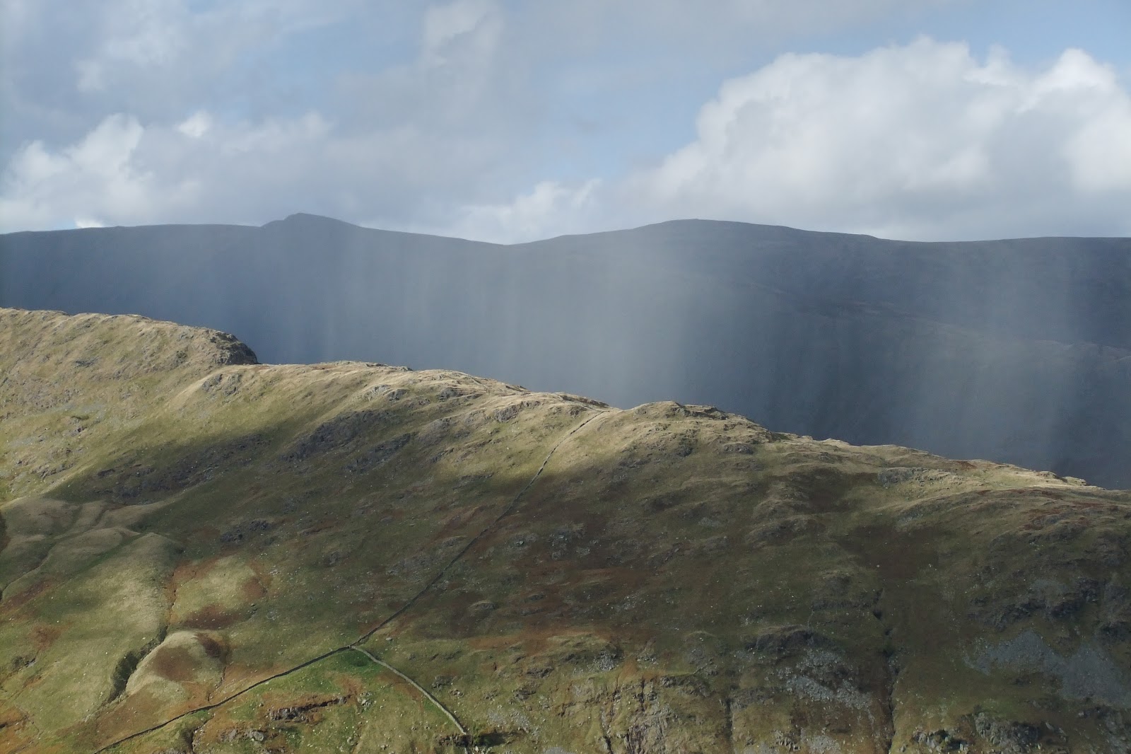
Passing rainshower
Picnic finished, we headed back down to Mardale Head. We watched as a rain shower passed by, like a curtain, over Haweswater in the distance. A rainbow added more colour to an autumnal fellside.
Seen walking down Gatescarth byway
We completed our walk, making quick progress along the Haweswater road back to our starting point. Sadly, the western lakeside permissive pathway had been closed, but we were able to enjoy the many watercourses that were flowing down the fellside to drain into the reservoir. The water was running beautifully clear. 

Although this walk had been relatively featureless, it had not been as demanding as the previous day's walk. We'd been fortunate enough to be able to make the most of the good weather and walked up another two Wainwrights. It had given us wonderful views of the High Street ridge and as far afield as the Howgills, Pennines and the sea. We had passed only three people all day. 

Priceless.